


Le Revard la Féclaz le Revard

Jeanlefevre
User
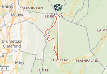

Length
11.5 km

Max alt
1501 m

Uphill gradient
325 m
Km-Effort
16 km

Min alt
1323 m

Downhill gradient
370 m
Boucle
No
Creation date :
2022-01-11 07:28:31.0
Updated on :
2022-01-11 16:20:49.811
2h20
Difficulty : Easy

FREE GPS app for hiking
 SityTrail
IGN / Geographical institutes
SityTrail Plus
The world is yours!
About
Trail Walking of 11.5 km to be discovered at Auvergne-Rhône-Alpes, Savoy, Les Déserts. This trail is proposed by Jeanlefevre.
Description
Raquette
Positioning
Country:
France
Region :
Auvergne-Rhône-Alpes
Department/Province :
Savoy
Municipality :
Les Déserts
Location:
Unknown
Start:(Dec)
Start:(UTM)
731914 ; 5062992 (31T) N.
Comments